GARMIN
GPSMAP 1022 10in Plotter Worldwide Basemap
- Manufacturer part #
- 010-01740-00
- UPC
- 753759168308
- Condition
- New
$1,399.99
Estimated to ship by Monday, October 19.
Free ground shipping (48 states)
Garmin GPSMAP(R) 1022 10-inch Chartplotter Is All-in-1 Solution
Model: 010-01740-00UPC: 753759168308
- 10-inch color display with keypad interface and multifunction control knob
- High-sensitivity internal 10 Hz GPS and GLONASS receiver
- Fully network capable for Garmin Marine Network and NMEA 2000(R) plus NMEA 0183 support
- Supports optional BlueChart(R) g3 Vision(R) premium charts
GPSMAP 1022 is designed for cruisers, sailors and sailing racers who need the advanced all-in-1 solution provided by our 10-inch keyed chartplotter. Features a large, bright screen coupled with a quick and easy-to-use keypad interface with user-programmable keys and a multifunction control knob.
Garmin Marine Network support allows sharing of sonar, maps, user data, dome or open-array radar, IP cameras and PanoptixTM sonar among multiple units. Includes NMEA 2000 network connectivity and NMEA 0183 support for autopilots, digital switching, weather, FUSION-Link, VHF, AIS and other sensors.
Built in Wi-Fi gives you access to the free all-in-one ActiveCaptainTM app, so you can manage your marine experience from nearly anywhere. It creates a simple yet powerful connection between your compatible mobile device and your Garmin chartplotter, charts, maps and the boating community. Wherever you are, you'll have unlimited access to your cartography, the ability to purchase new maps and charts and access to the Garmin QuickdrawTM Contours Community. Stay connected with smart notifications on your chartplotter screen. You can also plan a trip or prefish a lake, and ActiveCaptain will automatically sync with your chartplotter. Even get notifications for software updates, and decide when to download them on your device.
Fast, responsive built-in 10 Hz GPS and GLONASS receiver refreshes your position and heading 10 times each second to make your movement on the screen more fluid. It makes dropping up to 5,000 accurate waypoints - and finding your way back to them - quick and easy.
Upgrade to optional premium BlueChart g3 Vision charts and LakeVü g3 Ultra maps. These add features such as high-resolution relief shading of bottom structure - which provides more 3-D relief than contours alone - satellite imagery and more.
To help you gain a wind-maximizing competitive edge, your chartplotter features a pre-race guidance page that shows your virtual starting line along with data fields showing laylines, time to burn before the start and a race timer that can be synchronized across all your networked Garmin GPS products. In addition, other supported sailing features include an enhanced wind rose, heading and course-over-ground lines, set and drift, true and apparent wind data and more.
If you have waypoints, tracks or frequently used routes stored on another manufacturer's GPS product - or on a Garmin handheld device - it's easy to transfer those items to your new Garmin chartplotter via industry-standard GPX software formatting.
Specifications| Performance and Physical | |
| Dimensions | 12.5 x 7.3 in x 2.7 in (318 x 185 x 69 cm) |
| Display size | 8.8 in x 4.9 in (224 x 125 cm) |
| Display resolution | 1024 x 600 |
| Display type | WSVGA display |
| Weight | 4.1lbs |
| Water rating | IPX7 |
| Power consumption | Max power usage at 10 Vdc: 32.4 W |
| Antenna | Internal or external over NMEA 2000 |
| Mounting options | Bail or flush |
| Receiver | 10 Hz high-sensitivity |
| Garmin Marine NetworkTM ports | 2 |
| Preloaded maps | None |
| Accepts data cards | 2 SDTM cards |
| Waypoints | 5 |
Specifications
Physical & Performance
| Physical dimensions | 12.5" x 7.3" x 2.7" (318 x 185 x 69 cm) |
|---|---|
| Display size | 8.8" x 4.9" (224 x 125 cm) |
| Display resolution | 1024 x 600 pixels |
| Display type | WSVGA display |
| Weight | 4.1 lbs (1.85 kg) |
| Antenna | Internal_or_external_over_NMEA_2000 |
| NMEA 2000® compatible | |
| NMEA 0183 compatible | |
| SiriusXM™ Weather & Radio compatible | |
| Power consumption | Max power usage at 10 Vdc: 32.4 W Typical current draw at 12 Vdc: 1.9 A Max current draw at 12 Vdc: 2.7 A |
| Mounting options | Bail or flush |
| Garmin Marine Network™ ports | 2 |
Maps & Memory |
|
| Preloaded maps | None |
|---|---|
| Accepts data cards | 2 SD™ cards |
| Waypoints | 5,000 |
| Routes | 100 |
| Track log | 50,000 points; 50 saved tracks |
Chartplotter Features |
|
| Garmin Radar compatible | |
|---|---|
| Garmin Sonar compatible | Yes (with external black box, sold separately) |
| Garmin SmartMode compatible (customizable monitor presets) | |
| Supports AIS (tracks target ships position) | |
| Supports DSC (displays position data from DSC-capable VHF radio) | |
| Tide tables | |
| Garmin Meteor™ Audio System compatible | |
| Supports FUSION-Link™ compatible radios | |
| GSD™ Black Box sonar support | |
| GCV™ Black Box sonar support | |
| BlueChart® Mobile (planning) compatible | |
| Garmin Helm compatible | |
| GRID™ (Garmin Remote Input Device) compatible | |
| Wireless remote compatible | |
Sonar Features & Specifications |
|
| CHIRP sonar technology | Yes (with external black box) |
|---|---|
| ClearVü | Yes (with external black box, sold separately) |
| SideVü | Yes (with external black box, sold separately) |
Connections |
|
| NMEA 0183 input ports | 1 |
|---|---|
| NMEA 0183 output ports | 1 |
| Video input ports | 1 BNC |
| Video output ports | None |
| Wireless connectivity | |
Package contents
- GPSMAP 1022 chartplotter
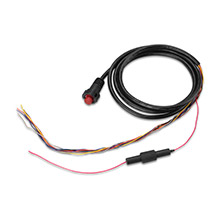
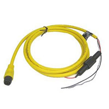
- Power/data cable
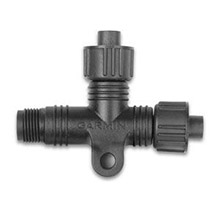
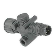
- NMEA 2000 T-connector
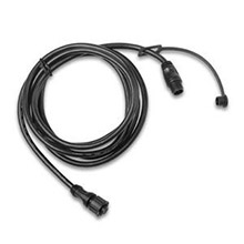
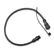
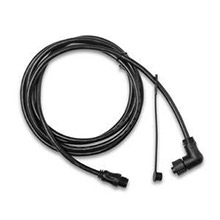
- NMEA 2000 drop cable (2 m)
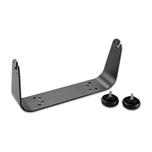
- Bail mount kit with knobs
- Flush mount kit with gasket
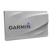
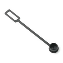
- Protective cover
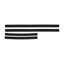
- Trim piece snap covers
- Documentation
Shipping weight: 9.1 lb
63 accessories in 12 categories. Choose one to see its parts.